New guide to better riparian areas in the Willamette Valley

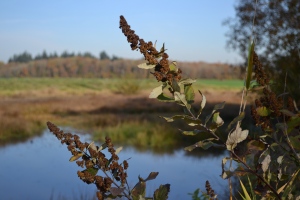
Douglas Spirea in a Willamette Valley riparian area. Photo by Jared Kinnear.

CORVALLIS, Ore. – The health of fish and wildlife and the quality of the water they call home depend in large measure on the trees and shrubs that grow in riparian areas along streams and riverbanks.

Although the task is not easy, riparian areas that are damaged can be replanted. Six manageable steps are detailed in a comprehensive Oregon State University guide written by OSU Extension foresters Glenn Ahrens, Max Bennett and Brad Withrow-Robinson.

The new 27-page booklet, “A Guide to Riparian Tree and Shrub Planting in the Willamette Valley: Steps to Success,” is available free from OSU Extension online at: http://bit.ly/OSUESem9040

In healthy riparian areas, plants help control erosion and trees give shade to cool the water. Leaves and insects drop into the water to feed fish, and migratory songbirds nest in well-developed shrub layers.

Efforts to restore riparian areas in Oregon have become more common during the last several years, Withrow-Robinson said. But the success of riparian plantings varies widely, and some fail.

“Problems arrive because seedling survival and growth are often poor, competition from weeds can be high, soil texture can vary widely and animal damage is common,” Withrow-Robinson said.

To help landowners, watershed councils and others avoid the obstacles, the guide gives information specific to the Willamette Valley, Withrow-Robinson said. “The valley is particularly challenging because summers are hot and dry and streams run through agricultural and urban areas that have been modified.”

The guide explains how to understand a watershed and what it needs the most.

“In western Oregon, warm stream water usually is the primary water-quality issue,” Withrow-Robinson said. The authors recommend that landowners examine their site and identify specific challenges such as frequent flooding, poorly drained soils and types of weeds.

Information tables in the guide compare characteristics of several seedling and stock species that flourish in the Willamette Valley and which plants and trees have a high tolerance to flooding, drought and shade. Because it’s important that planting is done right, the guide gives specifics on how to handle seedlings carefully, plant during the winter dormant season and use proper tools.

It also specifies how to minimize erosion, control weeds, prevent animal damage and consider if irrigation is needed.

Wetlands shrink slows during last five years, need to conserve continues

WASHINGTON — America’s wetlands declined slightly from 2004-2009, underscoring the need for continued conservation and restoration efforts, according to a report issued today by the Department of the Interior’s U.S. Fish and Wildlife Service. The findings are consistent with the Service’s Status and Trends Wetlands reports from previous decades that reflect a continuous but diminishing decline in wetlands habitat over time.

The report, which represents the most up-to-date, comprehensive assessment of wetland habitats in the United States, documents substantial losses in forested wetlands and coastal wetlands that serve as storm buffers, absorb pollution that would otherwise find its way into the nation’s drinking water, and provide vital habitat for fish, wildlife and plants.

“Wetlands are at a tipping point,” said Secretary of the Interior Ken Salazar. “While we have made great strides in conserving and restoring wetlands since the 1950s when we were losing an area equal to half the size of Rhode Island each year, we remain on a downward trend that is alarming. This report, and the threats to places like the Mississippi River Delta, should serve as a call to action to renew our focus on conservation and restoration efforts hand in hand with states, tribes and other partners.”

“This report offers us a road map for stemming and reversing the decline,” said Fish and Wildlife Service Director Dan Ashe. “It documents a number of successes in wetlands conservation, protection and reestablishment, and will be used to help channel our resources to protect wetlands where they are most threatened and reduce further wetland losses.”

The net wetland loss was estimated to be 62,300 acres between 2004 and 2009, bringing the nation’s total wetlands acreage to just over 110 million acres in the continental United States, excluding Alaska and Hawaii.

The rate of gains from reestablishment of wetlands increased by 17 percent from the previous study period (1998 to 2004), but the wetland loss rate increased 140 percent during the same time period. As a consequence, national wetland losses have outpaced gains.

The net loss includes a combination of gains in certain types of wetlands and losses in other types, especially forested wetlands.

“In a five year period, we lost over 630,000 acres of forested wetlands, mostly in the Southeast – an area equal to half a million football fields each year,” Director Ashe said. “We should all be concerned about the substantial loss of this diminishing resource, which helps ensure good water quality for local communities and provides vital habitat for a diversity of important wildlife species.”

The southeast United States, primarily freshwater wetlands of the Atlantic and Gulf coastal plain, and the Lower Mississippi River experienced the greatest losses. Losses were also observed in the Great Lakes states, the prairie pothole region, and in rapidly developing metropolitan areas nationwide. The reasons for wetland losses are complex and reflect a wide variety of factors, including changes in land use and economic conditions, the impacts of the 2005 hurricane season on the Gulf Coast and climate change impacts.

This report does not draw conclusions regarding the quality or condition of the nation’s wetlands. Rather, it provides data regarding trends in wetland extent and type, and it provides information to facilitate ongoing collaborative efforts to assess wetland condition. Further examination of wetland condition on a national level has been initiated by the Environmental Protection Agency in conjunction with the U.S. Fish and Wildlife Service and other federal, state and Tribal partners.

Wetlands provide a multitude of ecological, economic and social benefits. They provide habitat for fish, wildlife, and a variety of plants. Wetlands are nurseries for many saltwater and freshwater fishes and shellfish of commercial and recreational importance. Wetlands are also important landscape features because they hold and slowly release flood water and snow melt, recharge groundwater, act as filters to cleanse water of impurities, recycle nutrients, and provide recreational opportunities for millions of people.

The report, Status and Trends of Wetlands in the Conterminous United States 2004-2009, is the most recent of the five reports to Congress reporting on the status and trends of wetlands across much of the United States since the mid-1950s.

Source: USFWS

Preventing Biological Invasions is a Gardener’s Responsibility

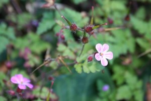
Herb Robert is a common garden invader and problem for its ability to move around with garden soil, plants, pets and clothes. Photo by R. Emanuel.

Most gardeners are unaware that they often inadvertently play roles in the spreading invasion of noxious weeds. But they also can learn to avoid, guard against and eliminate plants that try to escape the boundaries of their gardens.

“Biologists estimate that between 30 and 80 percent of invasive plant species introduced to the United States originated as garden plants,” said Linda McMahan, one of the authors of a new Oregon State University Extension publication, “Invasive Species: What Gardeners Need to Know,” EM 9035, available online at http://bit.ly/pEGJVQ

“In Oregon alone, 21 designated noxious weeds cost approximately $125 million a year in production losses, fire damage and control,” she said. Researchers have determined that almost half of the 1,000 plants and animals protected under the U.S. Endangered Species Act have been listed because of biological invasions.

Plant invasion occurs in three distinct phases:

Introduction. Gardeners can introduce and establish invasive species as they bring a new plant into their garden and perhaps share it with neighbors through plant or seed exchange. The plant population may experience a lag time in its reproductive ability, in which it will stay in a controlled situation such as a garden, forest or pasture. The plant does not appear to be overly aggressive. In some cases, the lag period can persist for decades.

Escape. During the second phase, an escaped plant appears to jump out of the garden into the neighboring landscape. Often this means a plant has overcome barriers that have kept it in check and prevented its spread. These barriers may include temperature, moisture, pests or competition from other plants.

Invasion. Eventually, the plant population shows signs of invasion. During this phase, the plant rapidly reproduces by sexual means (seeds) or asexual means (roots/rhizomes or creeping stems) and may spread over large distances.

The OSU Extension publication points out that gardeners can take control over the introduction and escape phases of a new invasion if they evaluate their potential plant choices first. “Responsible consumers can become informed prior to making a purchase,” McMahan said. Several websites can point the way (see below).

Sometimes a plant’s invasive potential can be arrested by watching it grow in the garden. When a plant starts to show an ability to escape the designated garden or landscape boundaries, the gardener needs to deadhead, trim or otherwise prevent the plant from escaping.

If someone gives you a start or seed, ask where the plant is from and if it is native to Oregon. How successful was the plant in the garden? Does the plant produce many seeds that sprout more than a few feet away from the original plant?

What are the alternatives to invasive species? The publication strongly recommends that they be replaced with Pacific Northwest natives and advises how to get rid of invasive species already in the garden. Many nurseries carry and order more native plants than previously, McMahan said.

Websites to help identify invasive species:

•  Oregon Department of Agriculture’s Oregon State Noxious Weed List is an authoritative listing of plants officially designated as noxious weeds in the state. http://egov.oregon.gov/ODA/PLANT/WEEDS/statelist2.shtml

•   Oregon Public Broadcasting’s Silent Invasion website provides a photographic list of invasive species of concern in Oregon. http://www.opb.org/programs/invasives/guide.php

• The United States Department of Agriculture Natural Resources Conservation Service’s PLANTS Database allows the user to track plants for their occurrence in individual counties throughout 49 states. Users can use the website to determine whether a plant is invasive by referring to the Invasive and Noxious Weeds page. http://plants.usda.gov/java/noxiousDriver

• Closer to home (for me), Clean Water Services maintains a website with a focus on identifying non-native invaders in our area. http://cleanwaterservices.org/Residents/JoinTheCycle/InYourYard/Invasives/

• Also, check out the 4 County Cooperative Weed Management Area and their compendium of Portland-area weeds: http://4countycwma.org/urban-weed-control/

•   The University of Montana’s Invaders Database System allows users to search for invasive species by name, state or area in the five northwestern states or access lists of noxious weeds for all U.S. states and six Canadian provinces. http://invader.dbs.umt.edu

New Report Examines Low Impact Development Benefits & Costs

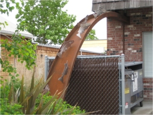
Creative rain garden downspout in SE Portland. Photo by Candace Stoughton, EMSWCD.

Clean water and vibrant communities go hand in hand. Urban areas are increasingly using green infrastructure to create multiple benefits for their communities. However, there have been questions whether strong stormwater standards could unintentionally deter urban redevelopment and shift development to environmentally damaging sprawl. Working together, Smart Growth America, American Rivers, River Network, the Center for Neighborhood Technology, and NRDC commissioned a report by ECONorthwest, Managing Stormwater in Redevelopment and Greenfield Development Projects Using Green Infrastructure. Highlighting several communities that are protecting clean water and fostering redevelopment, the findings show that clean water and urban redevelopment are compatible.

To read the report:
http://www.americanrivers.org/assets/pdfs/reports-and-publications/stormwater-green-report.pdf

To read the executive summary:
http://www.americanrivers.org/assets/pdfs/clean-water-/managing-stormwater-executive.pdf

To learn more, River Network will host a webinar on this work by ECONorthwest lead researchers on August 17th, 1:00 EST/10:00 PST – to reserve a spot: http://www.rivernetwork.org/forms/rsvp-river-network-webinars

Rainwater harvesting conference comes to Oregon

When I lived in Tucson a few years ago, I had a rainwater collection cistern and a passive rainwater harvesting system in my home landscape. The people who helped design these simple yet powerful techniques formed a larger organization called the American Rainwater Catchment Systems Association. There are some big names in the field who generally gather in these conferences. For those of you interested in rainwater harvesting, I would recommend attending, and if you can afford it, participating in one of the workshops they offer in conjunction with the event.

American Rainwater Catchment Systems Association 2011 National Conference

September 27 – 29
Clackamas, OR

Continue reading

Yes, H2ONCoast has really moved.

If you are a regular reader and found this blog by accident, you might be confused. Yes, it is H2ONCoast. Yes, the author is the same. No, it’s no longer hosted within Oregon State University’s corner of the blogosphere. But H2ONCoast has been in existence since 2007 and I’m not about to let it go away.

Update: I am moving from OSU to a new employer (and it’s not time to reveal that detail). I am very proud of my work with that OSU and Oregon Sea Grant Extension. But as John Lennon once sang “life is what happens when you’re busy making other plans.”  Despite that, you will continue to see some OSU-related content here.

H2ONCoast is migrating into the private realm of the blogosphere. I’ll do my best to support it on my own. You might find things change a bit with time and situation, but I’ll do my very best to keep serving up all things water and watersheds from my new perch.

One thing that might change–I am now living in Portland metro area and not on the North Coast. So expect some more urban, Columbia River and Willamette Valley watershed issues to appear here.

Thanks for sticking with H2ONCoast all these years! –Rob

P.S. I’m trying to deal with the bugs with embedded code (re: Slideshare and video) that the move has created. Thanks for your patience.

Got Knotweed? New OSU publication offers solutions.

Note, this is a reposted press release by Judy Scott, OSU Extension and Experiment Station Communications. And yes, this is my publication listed below so if you have questions, please contact me directly.

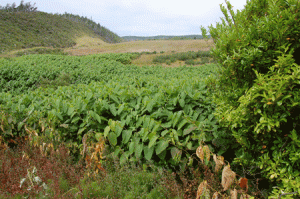
Giant knotweed spreads in a coastal community in Oregon.

Giant knotweed spreads in a coastal community in Oregon. Photo by R. Emanuel, OSU.

If ever a case needs to be made against introducing non-native plants to a new area, “woody knotweed” says it all. Like a sci-fi beast from outer space, woody knotweed seemingly wants to take over the Earth.

Imagine a weed that you can’t pull, cut or mow because you’ll encourage denser new growth.

Woody knotweed reproduces itself readily from small pieces of its own roots and stems and can contaminate the soil in which it grows. Knotweed-infested soil is considered a hazardous material in the United Kingdom.

A new Oregon State University Extension publication called “Biology and Management of Knotweeds in Oregon: A Guide for Gardeners and Small-Acreage Landowners” explains that the plant cannot be reasonably managed by non-chemical means. The publication is online and free of charge at http://bit.ly/OSUESem9031 Continue reading

Don't Move a Mussel in the PNW!

Just last month, Oregon Department of Fish and Wildlife inspectors discovered zebra mussels attached to a Michigan-based recreational boat arriving in Oregon at the Ashland Port of Entry. This was a strong wake-up call that the devastating mussels are on their way. It will only take one boat and one organism to infest Oregon waters.

US Fish and Wildlife Service have produced this video for helping show how easy it is to spread the mussels and how easy it is to prevent that spread into our state’s precious waterways.

To learn more about zebra and quagga mussels and programs aimed to prevent and detect their invasion, visit: http://www.100thmeridian.org.

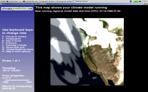
Contribute to Climate Prediction on Your Home Computer

Are you interested in climate change prediction? Though a Pew Center poll from last fall put concern for climate change at the bottom of the list of most American’s environmental priorities, many profess an interest in determining the direction of climate in this century (regardless of their opinions about the sources of climate trends).

The key issues with climate prediction are complicated at best but can boiled down to three important themes:

  • Can we find the range of change that can be expected under various scenarios?  How warm can we get and where will that warming be most felt?  Will it be 1 degree Celsius or 7?  This is largely a question of understanding the physics of our planet, sun and atmospheric “skin.”
  • Can we determine the sensitivity of the planet’s various systems to change?  This is a question of where warming will occur and how it will impact ecosystems, agriculture, oceans, or specific weather patterns.
  • Can we get to climate prediction that balances appropriate scale against societal relevance?  This is an important question because most of the common climate change reports show results that are of fairly course resolution. That is to say, when you look at your home, community or even state on a climate change map, it is usually just a tiny dot on a big spot on the map that is different in 20, 50 or 100 years time.  Getting the spots–or more accurately, the grids–to be smaller is important for answering questions about local temperature, rainfall and other predicted changes. These grids have to be big enough, however, to encompass change information.

Answering these questions is done by modeling the climate system (solar energy inputs, clouds, heat-trapping gases, ocean absorption, vegetation, snow and ice, etc.) against the historical records–some really old such as ice core or tree ring data or more modern like weather records since 1870–and current trends in, for example, volcanic eruptions and greenhouse gas emissions. Until recently, most of that was done by enormous–“super”–computers that could make the millions–and billions–of different computations happen quickly and repeatedly. Continue reading

Catastrophic amphibian declines have multiple causes

CORVALLIS, Ore. – Amphibian declines around the world have forced many species to the brink of extinction, are much more complex than realized and have multiple causes that are still not fully understood, researchers conclude in a new report.

The search for a single causative factor is often missing the larger picture, they said, and approaches to address the crisis may fail if they don’t consider the totality of causes – or could even make things worse.

No one issue can explain all of the population declines that are occurring at an unprecedented rate, and much faster in amphibians than most other animals, the scientists conclude in a study just published in the Annals of the New York Academy of Sciences. Continue reading